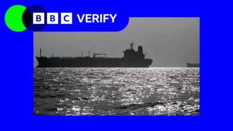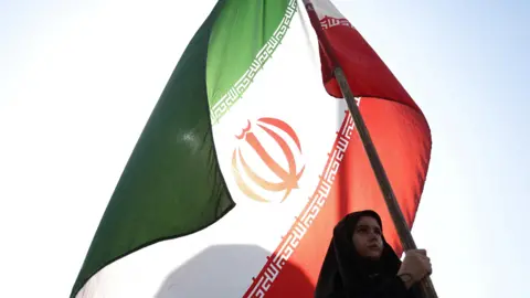
Humanitarian organisations and journalists have expressed concerns after a leading satellite imagery company told its users it was restricting access to images of Iran and large parts of the Middle East following a request from the US government.
California-based Planet Labs initially introduced a 14-day delay on providing new imagery from the region in March. It has since moved to an indefinite restriction.
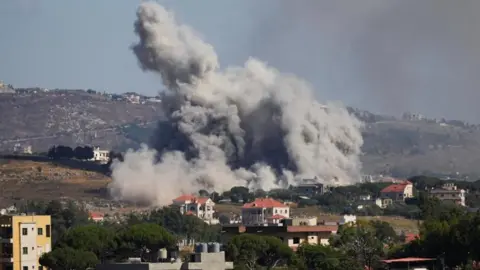
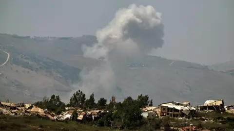
The decision has limited how journalists, humanitarian groups and analysts can use satellite images to assess the impact of the US-Israel war with Iran, including damage to military targets and civilian infrastructure.
It is unclear what prompted the US to press Planet to suspend its coverage and the Department of Defense did not respond to a request for comment.
Planet initially said its original 14-day delay policy was to ensure our imagery is not tactically leveraged by adversarial actors to target allied and Nato-partner personnel and civilians. It said in a statement to BBC Verify that it was now switching to a system of managed distribution and would share selected images on a one-off basis until the security risk has abated.
It declined to say how extensive the restrictions were. But based on BBC Verify's access to the portal it appears to extend across most of the Middle East, including Iraq, Lebanon, Israel and Gaza.
One satellite imaging expert told BBC Verify that companies like Planet that have military contracts can sometimes implement voluntary compliance requests that are actually driven by commercial incentive structures.
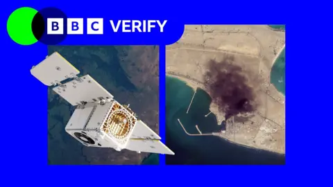
BBC Verify has used Planet imagery across the Middle East in its reporting, including since the war in Iran began at the end of February - such as when a US strike on a school in the Iranian town of Minab.
The changes now mean that images taken after 9 March are no longer routinely available to the company's clients.
Satellite imagery has become a key tool for reporters, especially in conflict zones, disasters, and other restricted environments where reporters cannot safely access the scene or where information is tightly controlled.
Planet's business model is similar to others in the industry. It has been expanding its work with the US defence sector, including the US National Geospatial Intelligence Agency and - through a subsidiary - the US Navy. It also works with the German and Swedish militaries.
There have also been concerns that bad actors have seized on the restrictions placed on Iranian imagery to proliferate fakes online. In the absence of Planet's services, its news clients - such as the BBC and the New York Times - have been turning to non-US based solutions, though these alternatives often do not offer the same level of detail or coverage as Planet's imagery.
Harrison suggested that the trend of restrictions on satellite imagery would likely continue as the industry grows and new providers emerge, challenging the effectiveness of such measures.
California-based Planet Labs initially introduced a 14-day delay on providing new imagery from the region in March. It has since moved to an indefinite restriction.
The decision has limited how journalists, humanitarian groups and analysts can use satellite images to assess the impact of the US-Israel war with Iran, including damage to military targets and civilian infrastructure.
It is unclear what prompted the US to press Planet to suspend its coverage and the Department of Defense did not respond to a request for comment.
Planet initially said its original 14-day delay policy was to ensure our imagery is not tactically leveraged by adversarial actors to target allied and Nato-partner personnel and civilians. It said in a statement to BBC Verify that it was now switching to a system of managed distribution and would share selected images on a one-off basis until the security risk has abated.
It declined to say how extensive the restrictions were. But based on BBC Verify's access to the portal it appears to extend across most of the Middle East, including Iraq, Lebanon, Israel and Gaza.
One satellite imaging expert told BBC Verify that companies like Planet that have military contracts can sometimes implement voluntary compliance requests that are actually driven by commercial incentive structures.
BBC Verify has used Planet imagery across the Middle East in its reporting, including since the war in Iran began at the end of February - such as when a US strike on a school in the Iranian town of Minab.
The changes now mean that images taken after 9 March are no longer routinely available to the company's clients.
Satellite imagery has become a key tool for reporters, especially in conflict zones, disasters, and other restricted environments where reporters cannot safely access the scene or where information is tightly controlled.
Planet's business model is similar to others in the industry. It has been expanding its work with the US defence sector, including the US National Geospatial Intelligence Agency and - through a subsidiary - the US Navy. It also works with the German and Swedish militaries.
There have also been concerns that bad actors have seized on the restrictions placed on Iranian imagery to proliferate fakes online. In the absence of Planet's services, its news clients - such as the BBC and the New York Times - have been turning to non-US based solutions, though these alternatives often do not offer the same level of detail or coverage as Planet's imagery.
Harrison suggested that the trend of restrictions on satellite imagery would likely continue as the industry grows and new providers emerge, challenging the effectiveness of such measures.