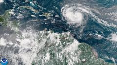
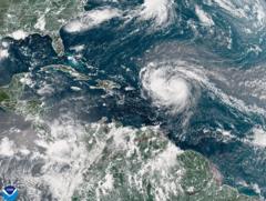
As the storm's impact looms, preparations are underway as authorities warn of severe weather conditions for the Eastern US region.
**Hurricane Erin Intensifies, Poses Threat to US East Coast**

**Hurricane Erin Intensifies, Poses Threat to US East Coast**
Hurricane Erin has escalated to a Category 4 storm, endangering coastal communities with perilous surf and currents.
Hurricane Erin has rapidly intensified to a Category 4 hurricane, generating life-threatening surf and rip currents along the United States East Coast. The storm is currently impacting the southeastern Bahamas and the Turks and Caicos Islands, where a tropical storm warning has been issued.
Although Erin is not anticipated to make landfall on these islands, residents can expect substantial rainfall, reaching up to six inches (15.2cm). Erin marked its presence as the first hurricane of the 2025 Atlantic season, initially strengthening explosively into a Category 5 storm before briefly diminishing in intensity and regaining power.
In Puerto Rico, over 150,000 residents experienced power outages due to strong winds damaging infrastructure. However, local energy provider Luma reported significant recovery efforts, restoring power to 95% of its customers by Sunday evening.
The storm's outer rain bands have begun impacting the Bahamas, prompting the US National Hurricane Center (NHC) to issue advisories. Although direct hits on the islands are not expected, the Disaster Risk Management Authority is urging locals to prepare for potential emergencies. Managing director Aarone Sargent emphasizes the need for residents to familiarize themselves with nearby shelters and alternatives should they be necessary.
According to the NHC, the forecast predicts Erin will pass east of the southeastern Bahamas today and drift between Bermuda and the eastern US coast mid-week. The storm is projected to remain "large and dangerous" throughout this period. Meanwhile, North Carolina's Outer Banks are bracing for severe conditions, including heavy surf and strong winds, prompting mandatory evacuations for Hatteras Island. The main highway linking Hatteras to surrounding areas is at risk of becoming impassable.
Forecasters have warmed residents of the potential for perilous rip tides that may extend along the entire East Coast of the US.


