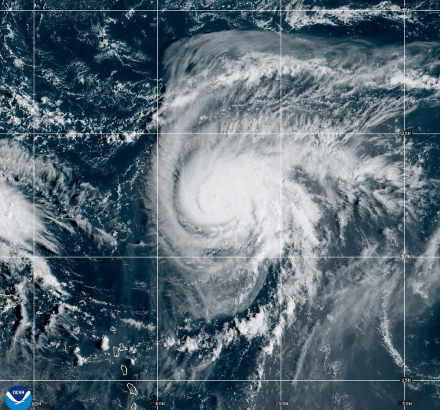
MIAMI (AP) — Dangerous tropical weather brewed Saturday in the Atlantic Ocean as Hurricane Humberto intensified into a powerful Category 4 hurricane, prompting concerns across the region. Maximum sustained winds of 145 mph (230 kph) were reported, with the storm located approximately 375 miles (605 kilometers) northeast of the northern Leeward Islands, moving west at 6 mph (9 kph).
Forecasters warned that Humberto could produce life-threatening surf and rip currents for the northern Leeward Islands, Virgin Islands, Puerto Rico, and Bermuda over the weekend. In tandem with Humberto, another weather system poised to develop into a tropical storm threatens the Bahamas and Cuba with heavy rainfall and flash flooding, with tropical storm warnings already issued in parts of the Bahamas.
South Carolina Governor Henry McMaster declared a state of emergency, allowing emergency officials to prepare for potential impacts as the storm approaches. Preparations in Charleston included sandbagging efforts and checks on high water vehicles, with authorities treating the situation seriously despite the tropical disturbance not yet forming.
Heavy rains from the tropical disturbance have already caused significant flooding in the Dominican Republic, resulting in evacuations and a red alert in several provinces. The Federal Emergency Management Agency urged coastal residents in the Southeastern U.S. to remain vigilant as the weather systems continue to develop.
In the Atlantic, the post-tropical cyclone Gabrielle moved away from the Azores, easing warnings for the Portuguese archipelago. Meanwhile, Hurricane Narda in the Pacific is maintaining its strength as it affects coastal areas of Mexico.